Immersive 360 Virtual Tours &; Floor Plans
Our latest offering combines two powerful services, Immersive 360 Virtual Tours and Floor Plans, both utilising the latest Matterport camera technology to provide comprehensive property visualisation solutions.
What are Immersive 360 Virtual Tours?
Immersive 360 Virtual Tours transport viewers into a captivating digital realm, offering a comprehensive and interactive exploration of properties. Using advanced Matterport camera technology, we capture high-resolution panoramic images and stitch them together to create seamless, immersive experiences. With lifelike 360-degree views, viewers can navigate through properties as if they were physically present, gaining a deeper understanding of space, layout, and design.
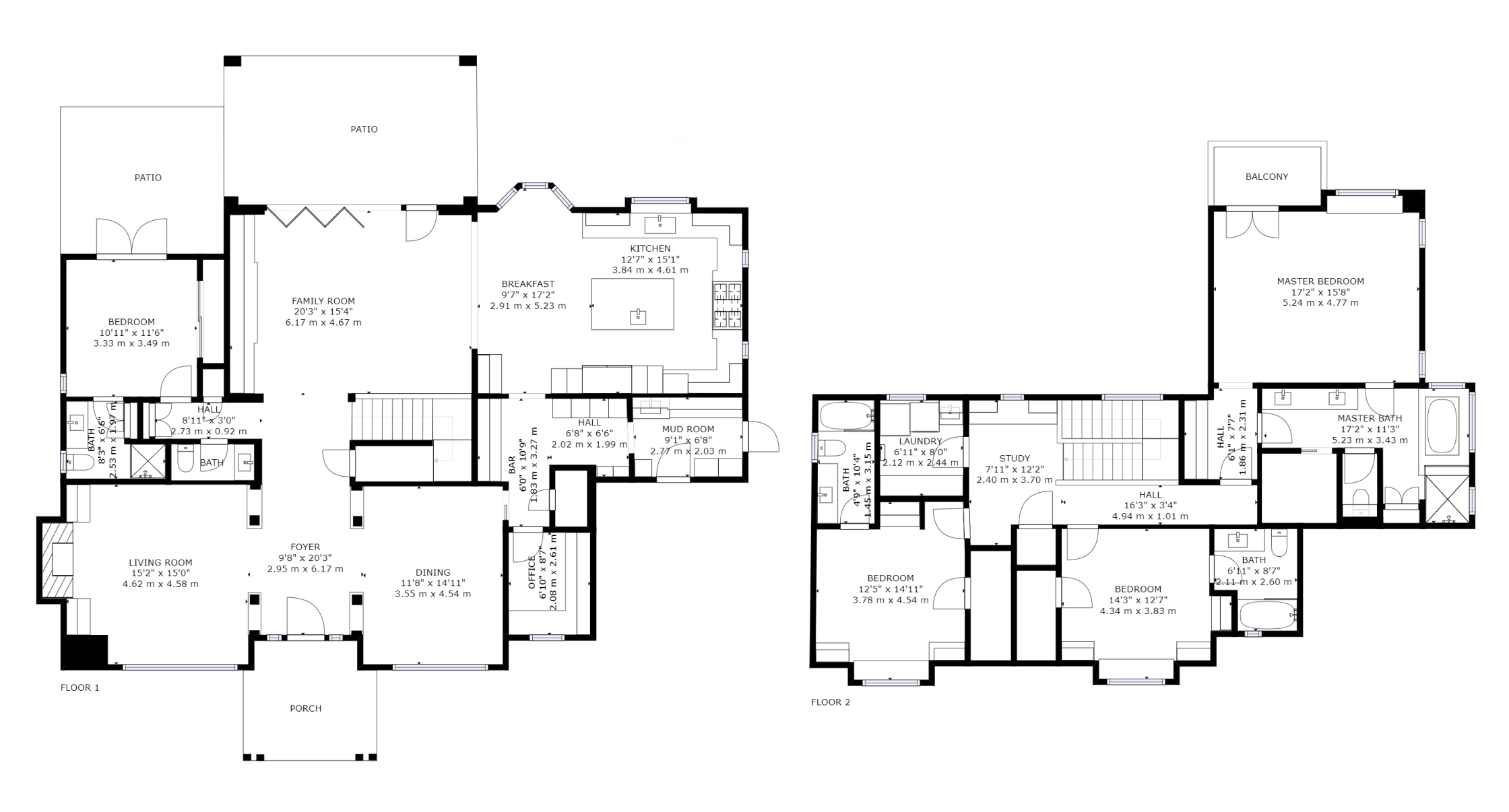
What are Matterport 3D Floor Plans?
Matterport 3D Floor Plans offer detailed and accurate representations of property layouts, created using the same cutting-edge Matterport camera technology. These floor plans provide precise measurements and spatial layout information, enhancing the understanding of property dimensions and configurations. Whether for real estate listings, construction projects, or property management, Matterport 3D Floor Plans offer unparalleled clarity and insight.
Benefits of Immersive 360 Virtual Tours & Floor Plans:
- Realistic Experience: Immersive virtual tours and detailed floor plans provide a realistic representation of properties, allowing viewers to explore and understand spaces with unprecedented realism.
- Remote Accessibility: Both virtual tours and floor plans enable remote exploration of properties, eliminating the need for physical visits and expanding reach to a global audience.
- Enhanced Engagement: Interactive features such as hotspots, annotations, and detailed floor plan views enrich the property viewing experience, engaging viewers and providing valuable information about key features and amenities.
- Comprehensive Visualisation: By combining virtual tours with floor plans, viewers gain a comprehensive understanding of property layouts, spatial relationships, and design features, facilitating informed decision-making.
Sectors Benefiting from Immersive 360 Virtual Tours & Floor Plans:
- Real Estate: Real estate agents and property developers can showcase listings effectively, attract more qualified leads, and differentiate their properties in a competitive market.
- Architecture & Design: Architects and designers can use virtual tours and floor plans to visualise design concepts, communicate ideas to clients, and streamline the design process.
- Property Management: Property managers can provide comprehensive property documentation to tenants, facilitate maintenance and renovations, and enhance tenant satisfaction.
- Construction: Construction professionals can use virtual tours and floor plans for project visualisation, progress monitoring, and coordination among stakeholders, improving project efficiency and quality.
We’re dedicated to leveraging technology to redefine how properties are visualised and experienced. With our Immersive 360 Virtual Tours and Matterport 3D Floor Plans, we offer comprehensive property visualisation solutions that empower stakeholders and enhance decision-making. Contact us today to learn more about how our services can transform your property showcasing efforts.